

Environmental Impact Visualisation
Quarry Extension | Brownfield Rehabilitation |
Landfill Site | Industrial Redevelopment | Major Infrastructure
A tool for building support for territorial development projects.
Environmental Impact Visualisation (EIV) is one of ASYMETRIE’s specialties, transforming your operating plans, topographic surveys and point clouds into photorealistic projections integrated into the real landscape. Whether you are preparing a permit application, an environmental impact assessment, a public consultation meeting or a presentation to investors, our team produces the visual materials needed to make the future evolution of your site tangible and easy to understand — for local residents, elected representatives, public authorities and financial partners alike.
Our method guarantees metric accuracy throughout the entire project timeline: initial state, successive phases and final state after redevelopment. While the environmental impact assessment provides the analysis, EIV makes the impact visible — helping to build support for the project more quickly.
For more information or to request a quote, contact us by email at info@asymetrie.be, by phone at +32 71 314 300 or via our form at the bottom of the page.
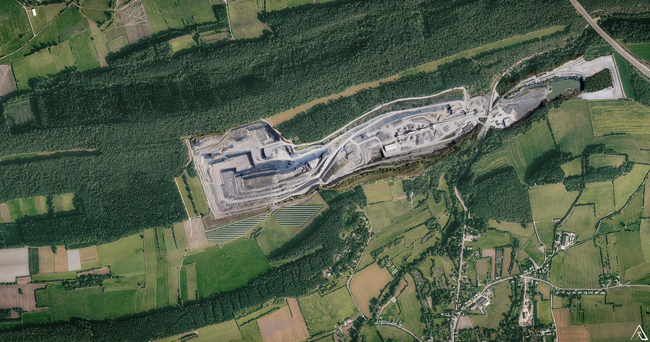
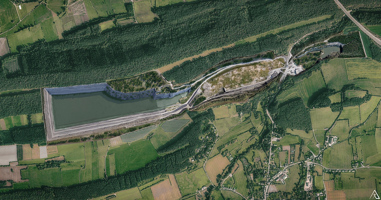
Even before construction begins, our visuals help you manage the project.
With our visualisation solutions, you can:
- present a clear, shared vision at public meetings, without fuelling mistrust,
- strengthen the clarity of your permit applications for technical review committees,
- anticipate concerns from local residents and elected representatives by visualising the final state, not just the construction phase,
- manage long-term operational phases internally, with a shared vision across management, on-site teams and partners,
- convince investors and partners by showing the future site before construction even begins.
In summary: a strategic tool to accelerate stakeholder support, strengthen approval applications and keep long-term projects moving forward.
Who is Environmental Impact Visualisation for?
Accredited environmental consultancies — you conduct the environmental impact assessment; we produce the visuals that support it, working as a rigorous and discreet subcontractor without encroaching on your area of expertise.
Industrial project owners — quarries, cement plants, waste management companies, energy operators: your projects are built for the long term, and so are our visuals.
Developers and public authorities — brownfield sites, infrastructure, redevelopment projects: we transform complex plans into shared visuals that help move decisions forward.
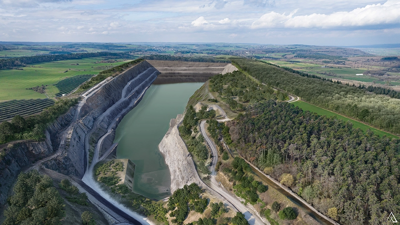
What sets ASYMETRIE’s Environmental Impact Visualisation apart
- Real landscapes — each projection is based on on-site photography, drone imagery or aerial views. In some cases, we create a CGI environment that closely reflects reality.
- Metric accuracy guaranteed through the direct integration of your topographic surveys and point clouds.
- Complete timeline — initial, intermediate and final states presented in a clear comparative format.
- Technical validity — visuals designed for review and validation by technical officials or permitting authorities.
- 25 years of expertise in 3D visualisation applied to high-stakes projects.